Remote Sensing Courses
Remote sensing courses can help you learn about satellite imagery analysis, geographic information systems (GIS), and environmental monitoring techniques. You can build skills in data interpretation, spatial analysis, and remote sensing applications in agriculture and urban planning. Many courses introduce tools like ArcGIS and QGIS, along with software for processing satellite data, that support analyzing and visualizing geographic information.
Popular Remote Sensing Courses and Certifications
Universidad Nacional Autónoma de México
Skills you'll gain: Analytical Chemistry, Analytical Testing, Chemistry, Data Analysis, Laboratory Testing, Vibrations, Engineering, Scientific, and Technical Instruments, Structural Analysis, Laboratory Research, Verification And Validation, Data Flow Diagrams (DFDs), Laboratory Techniques, Problem Solving, Pivot Tables And Charts, Quality Control, Data Collection, Physics
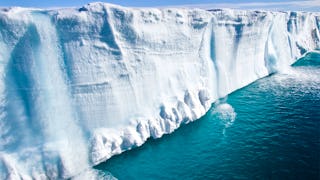
American Museum of Natural History
Skills you'll gain: Climate Change Mitigation, Social Sciences, Environmental Issue, Climate Change Adaptation, Socioeconomics, Economics, Policy, and Social Studies, Mitigation, Scientific Methods, Environmental Science, Physical Science, General Science and Research, Social Impact, Media and Communications, Hydrology, Mathematical Modeling, Simulation and Simulation Software, Model Evaluation
Google Cloud
Skills you'll gain: Apache Spark, Google Cloud Platform, Cloud Management, Cloud Computing, Distributed Computing, Package and Software Management
In summary, here are 3 of our most popular remote sensing courses
- Espectroscopía infrarroja: Algoritmo de interpretación: Universidad Nacional Autónoma de México
- Our Earth's Future: American Museum of Natural History
- Distributed Image Processing in Cloud Dataproc: Google Cloud










