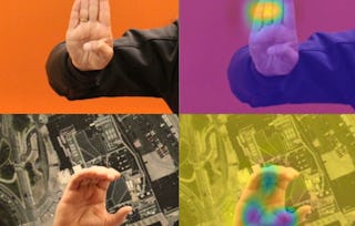
This hands-on course proves that deep learning isn't just about pressing "run" on a model. It's about turning satellite imagery into actual, useful insights. You'll work with convolutional neural networks for land cover classification, fine-tune a pre-trained CNN using transfer learning, use data augmentation to improve performance, and apply Grad-CAM to see where the model is actually looking. Along the way, you'll practice translating raw satellite imagery into insights you can clearly communicate to others. You are required to have basic Python programming, familiarity with machine learning concepts, and introductory knowledge of neural networks and image data. Designed for beginners in machine learning and remote sensing, Deep Learn Imagery builds your confidence in both working with deep learning and explaining what your models are doing.

Deep Learn Imagery

Deep Learn Imagery
This course is part of Satellite Imagery, Remote Sensing & Machine Learning Specialization

Instructor: Professionals from the Industry
Included with
Gain insight into a topic and learn the fundamentals.
Beginner level
Recommended experience
2 hours to complete
Flexible schedule
Learn at your own pace
Skills you'll gain
Tools you'll learn
Details to know

Shareable certificate
Add to your LinkedIn profile
Recently updated!
April 2026
Taught in English
See how employees at top companies are mastering in-demand skills

Build your subject-matter expertise
This course is part of the Satellite Imagery, Remote Sensing & Machine Learning Specialization
When you enroll in this course, you'll also be enrolled in this Specialization.
- Learn new concepts from industry experts
- Gain a foundational understanding of a subject or tool
- Develop job-relevant skills with hands-on projects
- Earn a shareable career certificate

There are 3 modules in this course
Earn a career certificate
Add this credential to your LinkedIn profile, resume, or CV. Share it on social media and in your performance review.
Instructor
475 Courses90,550 learners
Offered by


Explore more from Machine Learning


Why people choose Coursera for their career

Felipe M.
Learner since 2018
"To be able to take courses at my own pace and rhythm has been an amazing experience. I can learn whenever it fits my schedule and mood."

Jennifer J.
Learner since 2020
"I directly applied the concepts and skills I learned from my courses to an exciting new project at work."

Larry W.
Learner since 2021
"When I need courses on topics that my university doesn't offer, Coursera is one of the best places to go."

Chaitanya A.
"Learning isn't just about being better at your job: it's so much more than that. Coursera allows me to learn without limits."
Advance your career with an online degree
Earn a degree from world-class universities - 100% online




¹ Some assignments in this course are AI-graded. For these assignments, your data will be used in accordance with Coursera's Privacy Notice.